Underground infrastructure detection and localization using deep learning enabled radargram inversion and vision based mapping.
Mengjun Wang, Da Hu, Junjie Chen, Shuai Li.
Automation in Construction, 154, 105004.
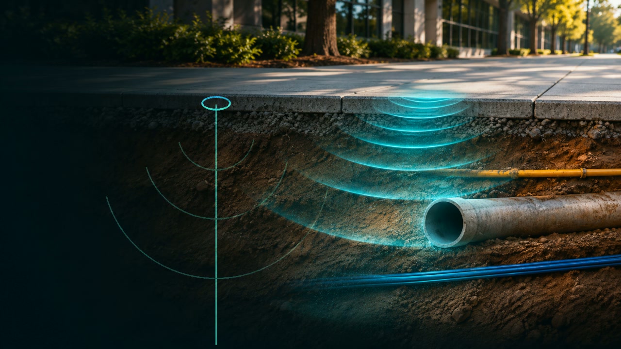
Learning-Based
Integrating GPR Inversion and Visual SLAM for Underground Infrastructure Detection and Localization.
Underground utility networks are often poorly documented, creating risks during excavation and infrastructure construction. Ground-penetrating radar (GPR) provides subsurface sensing capabilities, but interpreting radar signals and accurately locating buried utilities within physical environments remain challenging.
We integrate learning-based GPR inversion with vision-based spatial mapping to reconstruct subsurface properties, characterize buried utilities, and register their locations within the surrounding environment.
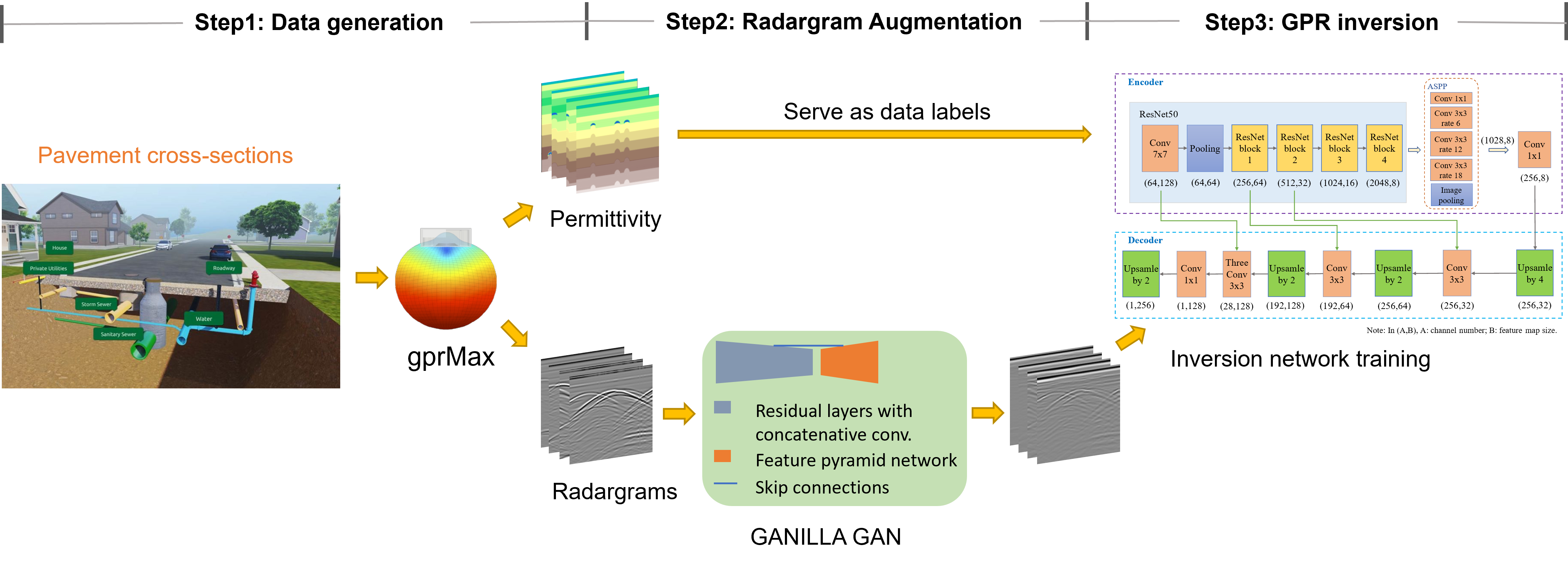
We develop an integrated framework that connects radar data generation, subsurface reconstruction, and spatial localization.
We use a generative adversarial network (GAN) to enhance simulated GPR radargrams for model training. A deep learning-based inversion model then reconstructs subsurface permittivity distributions from radar measurements, enabling the estimation of buried pipe locations, depths, and diameters.
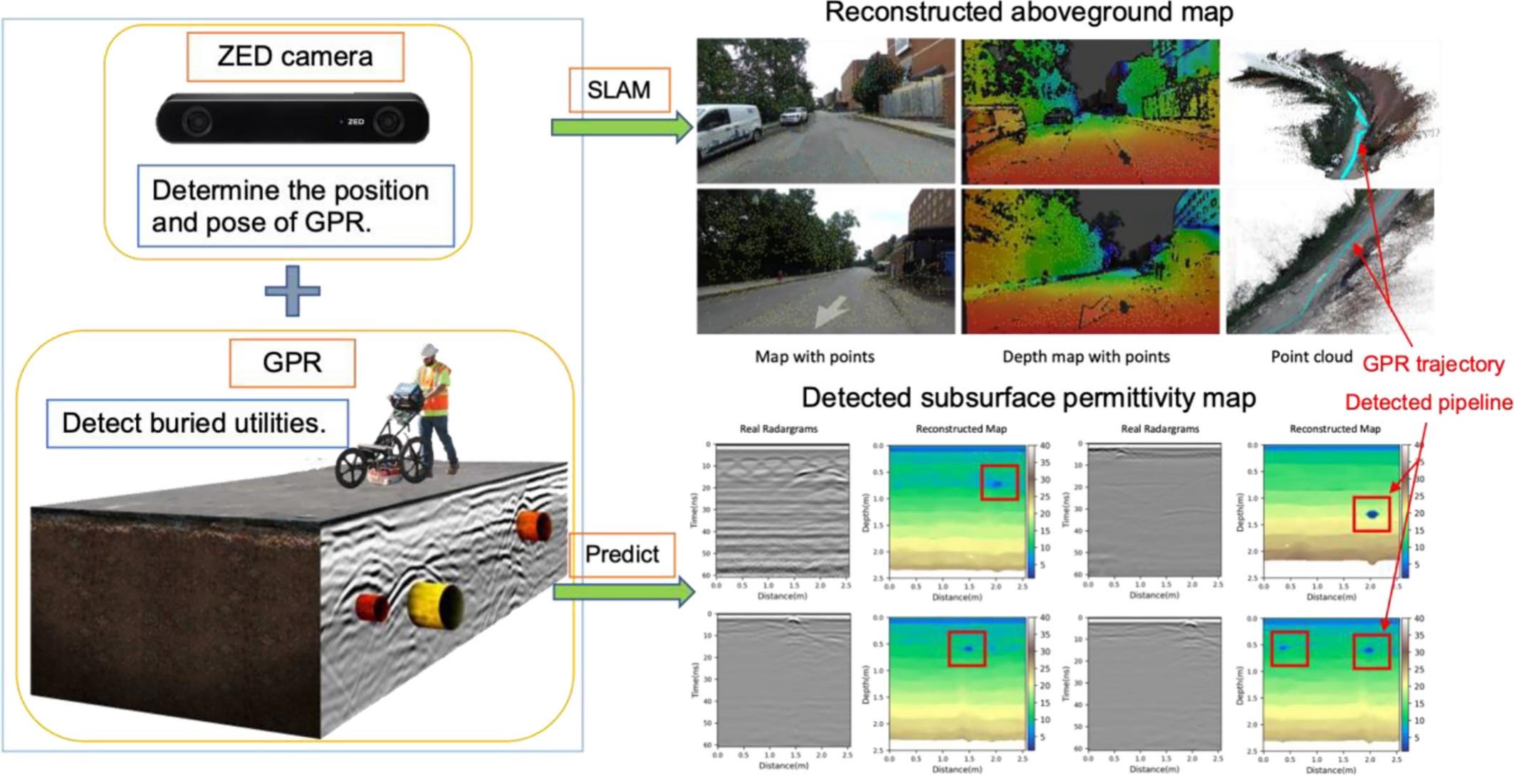
We integrate GPR-derived pipe detections with camera-based simultaneous localization and mapping (SLAM). By estimating the GPR survey trajectory and reconstructing the surrounding environment, detected underground utilities can be spatially registered within the site map.
100 simulated cases containing 388 buried pipes
Real-world experiments further demonstrate the feasibility of integrating GPR-based subsurface detection with vision-based spatial localization.
This research provides an integrated approach for transforming subsurface radar measurements into spatially registered utility information, supporting more informed excavation planning and underground infrastructure management.
Mengjun Wang, Da Hu, Junjie Chen, Shuai Li.
Automation in Construction, 154, 105004.
Mengjun Wang, Da Hu, Shuai Li, Jiannan Cai.
Winter Simulation Conference, pp. 2440–2450.
Jiannan Cai, JungHo Jeon, Hubo Cai, Shuai Li.
Journal of Computing in Civil Engineering, 34(3).
Jiannan Cai, Shuai Li, Hubo Cai.
Construction Research Congress 2018, pp. 712–721.
Shuai Li, Hubo Cai, Dulcy M. Abraham, Peng Mao.
Journal of Computing in Civil Engineering, 30(1).
Shuai Li, Hubo Cai, Vineet R. Kamat.
Automation in Construction, 53, pp. 105–119.
Shuai Li, Hubo Cai.
Computing in Civil Engineering 2015, pp. 419–426.